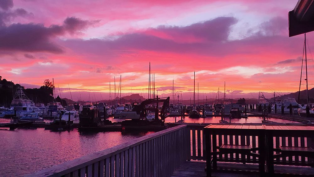
Whangaroa is an absolute hidden treasure, it has many beautiful anchorages and a marina that can handle all your needs as well as a sportsfishing club that has some of the best fish n chips in the world. So if you haven’t made the trip yet, make sure to add Whangaroa to the list of places you must see.
Whangaroa is the name of the harbour; also the name of the small town on the harbour’s southern side; and the name of the large area of land surrounding the harbour, formerly known as Whangaroa County.
But it’s not the historically correct name for these 3 localities. Somewhere along the way, we lost our ‘i’.
The actual name is Whaingaroa. In Maori tradition, the name commemorates the lament “whaingaroa” or “what a long wait” of a woman whose warrior husband had left for a foray to the south.
The Harbour
You can visit the harbour two ways – by land or sea.
By sea is the best way to enjoy the harbour’s attractions.
The Harbour by Sea
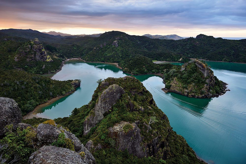
“A singular and beautifully romantic place” – Capt R. A. Cruise, HMS Dromedary, 1820.
Since the earliest overseas visitors, superlatives have been used to describe the harbour.
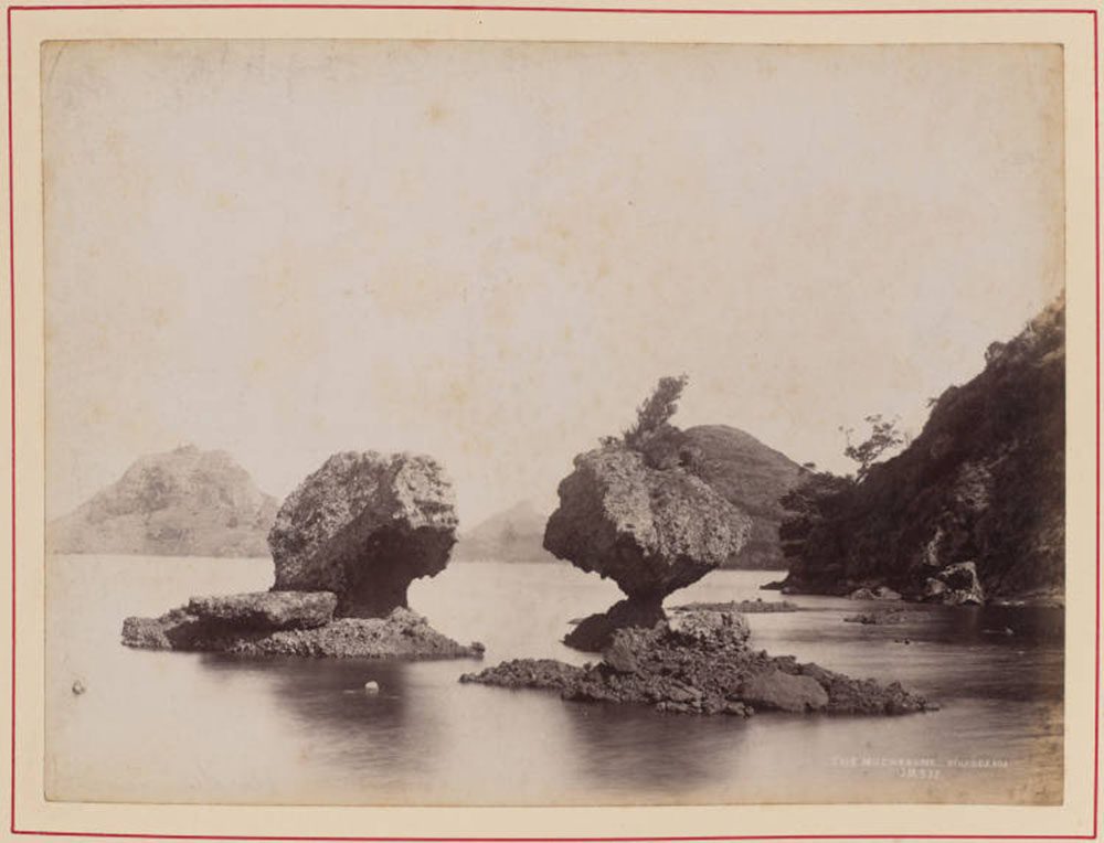
Whangaroa is a large harbour, in which there is a multitude of sheltered bays, with towering volcanic rock outcrops and idyllic sandy beaches.
There is a fleet of yachts, house-boats, and charter fishing boats available to get you out on the harbour.
A list of charter fishing boats is found on the Whangaroa Sport Fishing Club’s website. Many are available for harbour tours or a half day fishing charter. Serious anglers may wish to venture outside the harbour to our world famous deep sea fishing grounds in search of big game fish.
If sailing is more your style, there are two yachts available: Whangaroa Yacht Charters and ‘Snowcloud’.
For more adventurous seafarers, Northland Sea Kayaking specialises in helping you to explore the deeply indented coastline and islands of Whangaroa County, from Matauri Bay and the Cavalli Islands, the Whangaroa Harbour and northwards to Taupo Bay and beyond, including Stephenson’s Island.
Information for Visitors by Sea
If you are arriving at Whangaroa by sea, first time visitors may be surprised at the narrowness of our harbour entrance – just 200 metres wide. The channel in the harbour entrance is just over 16 metres deep at its shallowest point.
The area of harbour inside the entrance is roughly 12 square kilometres, so an enormous volume of seawater passes through the entrance with each tide. Consequently, at certain times (for instance, half-tide) the tidal current at the harbour entrance can be up to 5 knots (more than 9 kilometres per hour).
The relevant nautical chart is ‘Whangaroa Harbour and Approaches’ NU Marine Chart NZ 5114 (1:25,000 scale).
The Pickmere Atlas of Northland’s East Coast (1974/5 2nd edition) shows Whangaroa Harbour at 1:12,500 scale (page 10). Note: Soundings are in fathoms.
Speed Limit: The speed of all boats must be no more than 5 knots when the boat is within 200 metres of the shore or a structure (such as a wharf); or within 50 metres of another boat, raft or person in the water; or within 200 metres of another boat or floating structure carrying the Dive Flag.
Whangaroa Coastguard is based in Whangaroa Harbour and covers the area from the Cavalli Islands to Doubtless Bay.
Whangaroa Coastguard VHF radio CH84 is linked to Coastguard Northern Region and is manned 24/7.
CH84 should be used for all trip reports and emergencies. CH62 also covers the whole area and is for ship to ship communications and other local maritime uses. Outside the harbour the nowcasting service is available on CH20.
Weather broadcasts on CH 84: 0830; 1230; 1630; 2030 hrs.
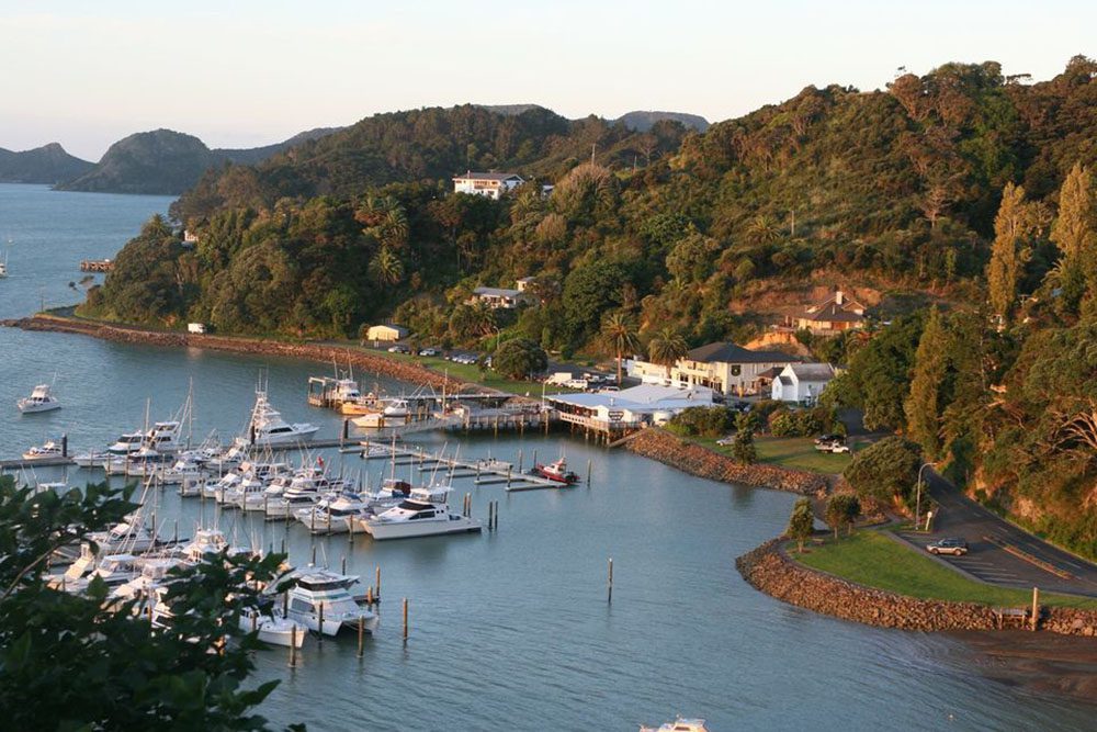
Whangaroa Marina can be contacted on CH12 once inside the harbour.
Whangaroa Marina has temporary berthage, as well as toilets, showers and laundry facilities. The marina office is located on the floating pontoon at the head of B Pier. The office is open from 08:30 to 09:30 and from 16:30 to 17:30 daily and longer hours during busy times. The manager can be contacted outside these hours on VHF CH12, CH62 or by mobile telephone: 0210 292 7270.
Fuel
(Diesel fuel only): Clansman Wharf, Ratcliffe’s Bay. Credit cards, BP fuel card.
Totara North Wharf. Credit cards, Mobil fuel card.
Fresh Water
Available from Whangaroa Coastguard Water Buoy situated in the Eastern Arm: 35º01.18 South, 173º46.07 East. $5 donation, please place in floating bottle.
Wharves
The harbour has three wharves, two on the Whangaroa (south) side and one on the Totara North (north) side of the harbour: the Marlin Wharf (with pontoon) opposite the Marlin Hotel, Whangaroa; the Clansman Wharf, 450 metres to the north of the Marlin Wharf; and the Totara North Wharf (with pontoon), at the end of Okura Bay Road.
There is a wharf and pontoon jetty at Kingfish Lodge for the use of guests.